Montana, like the rest of the western region of the United States, has undergone significant changes over the past 70 years. These changes include population growth and transformations in towns, cities, and landscapes. While some of these changes have been subtle, such as new stores or schools opening, others have been more dramatic, with entire neighborhoods evolving.
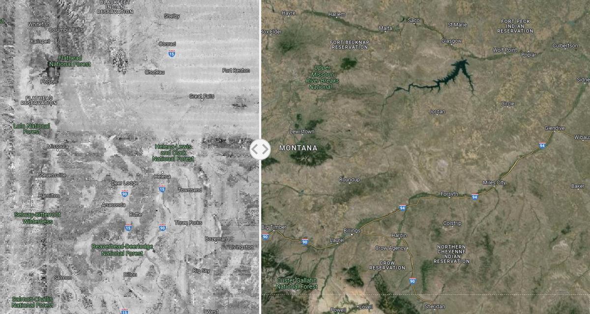
One project that highlights these changes is the Landscape Explorer, created by the University of Montana, Working Lands For Wildlife, Montana NRCS, and Intermountain West Joint Venture. This interactive map compares early satellite images from 70 years ago with modern images, showcasing the dramatic transformations that have occurred in the west.
Users can explore changes in their own neighborhoods as well as the broader picture of the western region using the Landscape Explorer website. The tool provides insight into the evolution of Montana and nearby states, offering a glimpse of how the world has changed and continues to change over time.
In addition to the Landscape Explorer, Google Earth images can be used to test one’s knowledge of Montana’s lakes from above. These images may reveal that the lakes are less recognizable from this perspective, adding a layer of intrigue to exploring and identifying these natural landmarks. Overall, these projects and tools offer a unique way to understand and appreciate the changes that have occurred in Montana and throughout the western United States.